Hugo Island Weather
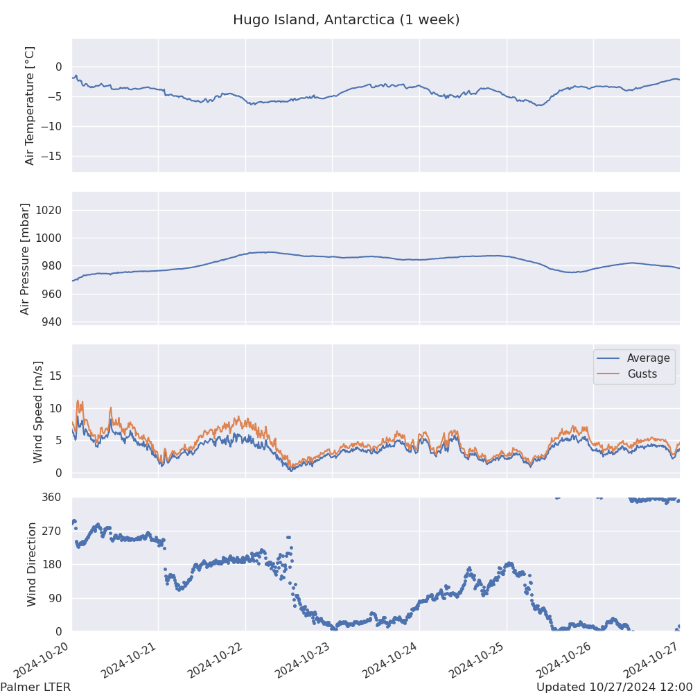
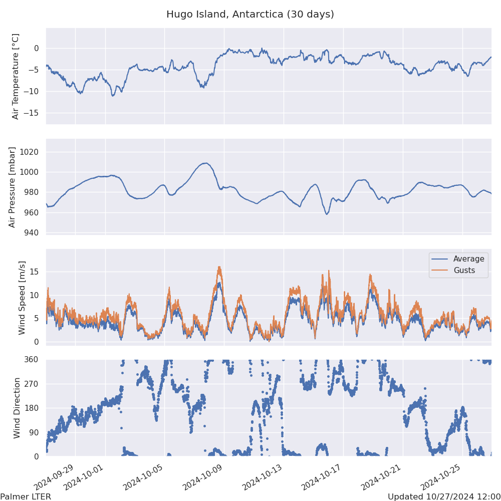
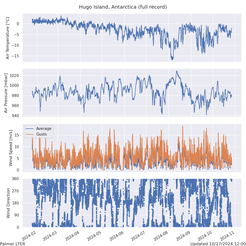
The following plots are updated daily (when available) and show the recent weather data from Hugo Island, Antarctica. See below for additional information about this site, which was installed in early 2024.
Station Information
In late January, 2024, the Palmer LTER Physical Oceanography team installed a weather station on Hugo Island (-64.96335°S, -65.66907°W), approximately 27 m above sea level.
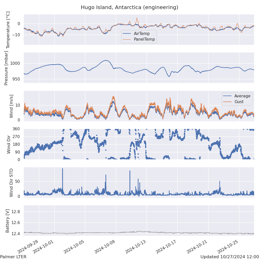
The station is mounted on top of a steel tripod and mast anchored directly into the rock and stabilized by 6 steel guy lines.
It includes sensors that record wind speed and direction, air temperature, and barometric pressure. Data is transmitted every 10 minutes utilizing short burst data (SBD) transmissions on the Iridium satellite network.
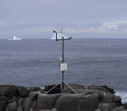
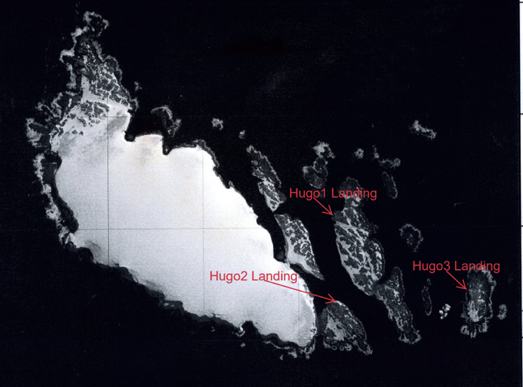
The station was placed on top of “Hugo3,” which is a small rocky island directly east of Hugo proper, and the large glacier there. This places it in an excellent position to record the oceanic conditions of the western Antarctic Peninsula continental shelf.
In addition to supporting LTER related research, the data are archived with the Antarctic Meteorological Research Center at the University of Wisconsin-Madison for the wider Antarctic research community and the public.
Data Access
Archived data from this site will be available from the Antarctic Meteorological Research and Data Center.
The AMRDC also provides real-time Meteorograms and Text Data files available as well.